


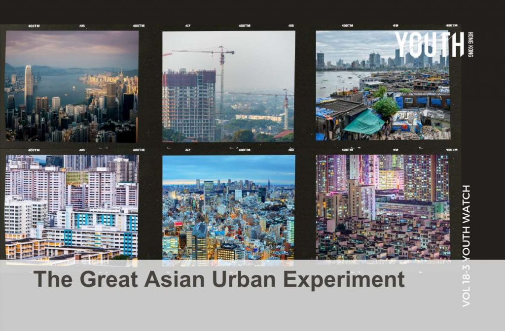
The urban fabric of a city depends on many factors. How do six Asian megacities handle density, population, housing, and environmental pressures through urban planning?
As home to many of the densest cities in the world, it’s impossible to exclude Asia from any discussion of urban planning or urban density. The diversity of the region showcases a variety of different approaches towards managing urban agglomeration, each influenced by their individual histories, economies, and geographies.
Hong Kong: #Crowded #Unaffordable
Despite its reputation as one of the most densely populated areas in the world, with iconic structures like Quarry Bay’s Monster Building and the now-demolished Kowloon Walled City, some 75% of Hong Kong is made up of undeveloped land. As a craggy collection of over 200 islands and islets, Hong Kong’s expansion of usable land has largely been achieved through land reclamation, including the extension of Hong Kong Island, Kowloon, and New Territories’ coastlines, as well as landmark projects like Chek Lap Kok Airport.
With limited space and a monopoly on land held by a small group of property developers, Hong Kong’s housing market has been ranked the least affordable in the world since 2010, disenfranchising young Hongkongers and deepening the city’s already-wide wealth gap. In September 2026, the Hong Kong government rolled out its inaugural five-year plan — the first deviation from its free-market style of governance since 1970 — to set long-term goals for its infrastructure, economic growth, and social welfare. A core focus area is the development of a 30,000-hectare “Northern Metropolis”, which aims to provide 650,000 jobs, housing for 2.5 million people, and further integrate the city with the Greater Bay Area over the next decade.
Shenzhen: #Migrants, #HandshakeBuildings, #GreenDevelopment
Established as China’s first Special Economic Zone (SEZ) in 1980, Shenzhen has transformed into a tech and industrial powerhouse with a population of 18 million in just four decades. Originally encompassing the core four districts of Luohu, Futian, Nanshan and Yantian, pre-existing farming and fishing settlements were razed to make way for purpose-built industrial parks, transport links, and urban infrastructure. As migrant workers flocked to the SEZ for economic opportunity, unplanned urban villages of densely clustered tenement buildings (called “handshake buildings” because neighbouring buildings were literally within arm’s reach) were built by rural landowners to meet housing demand.
In light of its economic success, Shenzhen has become a pilot city for experimental technology and policies. One major priority is sustainable development, with the Binhai Boulevard — a coastal highway that was rerouted to protect native mangroves — setting an important precedent in the 1990s. Today, the city has maintained an impressive 45% of green coverage; electrified its public transit system; retrofitted existing industrial buildings with solar panels and smart energy management systems; and built over 20 ecological corridors to connect forests, rivers, and coastal wetlands. One such example is the Kunpeng Trail No.1 Bridge, which provides safe passage to native wildlife such as leopards, boars, and otters between two mountains previously separated by an expressway.
Singapore: #GardenCity #Homeownership
Post-World War II, Singapore was reckoning with poor sanitation, high unemployment, and a shortage of natural resources and land, with many low-income residents squatting in tightly packed urban kampong villages. Upon taking office in 1961, Singapore’s founding father and first Prime Minister Lee Kuan Yew set out to transform the island into an efficient and orderly city-state through pragmatic and strict governance that prioritised stability and investment in its infrastructure, society, and economy.
The 1965 Land Acquisition Act, which empowered the government to purchase private land at controlled prices, enabled comprehensive urban planning of Singapore as a whole, with city planners mapping out long-term needs for industry, transport, housing, military, and green spaces decades in advance. Despite having a higher population density than Hong Kong, efficient land use and plentiful public housing financed by compulsory savings funds mean that eight out of ten Singaporeans own their homes, while the average living space per person is 300 square feet versus Hong Kong’s 170 square feet.
In its efforts to make Singapore a “city in a garden”, the government has invested heavily in tree-planting and park-building, and emphasised the importance of integrating greenery into both private and public property developments. Today, Singapore maintains nearly 50% green coverage through nature reserves, parks, gardens, and landmarks like Gardens by the Bay.
Tokyo: #Massive #Decentralised #Resilient
The economic and administrative heart of Japan, Tokyo is a massive metropolis that technically consists of 61 cities, towns, villages, and special wards — though the 23 special wards that make up its urban core are often referred to colloquially as Tokyo.
Tokyo’s urban design is deliberately decentralised, with the special wards functioning more like satellite cities connected by a vast transit network. Major hubs act as localised “downtowns” with clusters of mixed-use commercial and residential spaces, and the transit-oriented and pedestrian-centric layout keeps personal car usage in Tokyo among the lowest for a global megacity. While much of central Tokyo has been levelled on two separate occasions in the last century — the Great Kanto Earthquake of 1923 and firebombing by the United States during World War II — landowners rebuilt according to original property lines, preserving the historic layout of narrow streets and alleys and maintaining its human-scale feel.
Due to its vulnerability to natural disasters, resilience is a key consideration in Tokyo’s urban planning. As part of its official guidance for new development, Tokyo Metropolitan Government outlines measures like providing evacuation routes in flood zones through elevated walkways and including private power generators and three days’ worth of emergency supplies in large-scale urban developments.
Mumbai: #Inequality #Congestion #Expansion
As the long-time financial, commercial, and entertainment capital of India, Mumbai is a thriving centre of commerce that’s home to the highest number of billionaires in Asia. However, its extreme wealth inequality and lack of affordable formal housing has resulted in over 50% of the population residing in cramped, unsanitary slums.
Part of Mumbai’s issues lie in its geography. Originally an archipelago of seven islands, aggressive land reclamation transformed Mumbai into one long, narrow peninsula, with business districts concentrated on its southern tip. On a day-to-day basis, the linear orientation of the city causes severe congestion, while gradual urban expansion towards northern Mumbai only extends the proverbial traffic jam.
In an attempt to decongest Mumbai and meet housing demand in the 1970s, architects and urban planners built Navi Mumbai, a planned city across the harbour with housing for two million people, transport links, robust medical infrastructure, and ample green spaces. In 2026, officials are adopting the same approach with the ambitious Mumbai 3.0 project, while also pledging to reduce the city’s slum population by building 510,000 new homes on redeveloped land parcels by 2030.
Jakarta: #MostPopulated #LowWalkability
With the population of Greater Jakarta reaching 42 million in 2025, Jakarta has beaten Tokyo to become the most populated city in the world. As the commercial centre of Indonesia, Jakarta has seen explosive growth in recent decades, which has simultaneously boosted its economy while creating or exacerbating urban challenges like overcrowding, poor air quality, heavy traffic congestion, and fragmented governance.
Some of these issues can be attributed to Jakarta’s historically car-centric urban design. Despite its modernity, Jakarta only opened its rapid transit metro system in 2019, and walkability is low across the city as a whole. The most pressing of Jakarta’s concerns, however, is its vulnerability to flooding. Situated on low-lying coastal land, seasonal flooding is a regular occurrence in the city, which has only worsened due to subsidence caused by groundwater extraction and urban development.
In light of these issues, the Indonesian government announced in 2019 that it would be relocating the capital to a planned city called Nusantara within 10 years, though Jakarta will continue to operate under a special regional framework that recognises its economic and international significance. Meanwhile, the city is prioritising improvement works like mitigating subsidence and flood risks, increasing its transit-oriented development, and upgrading informal kampung settlements to provide better housing. ■
Sources
Hong Kong
- https://hongkongfp.com/2023/10/15/behind-slashed-prices-at-a-hong-kong-property-an-idle-seafront-site-hoarded-by-developers-for-20-years/
- https://www.scmp.com/news/hong-kong/hong-kong-economy/article/3363700/why-does-hong-kong-need-5-year-plan-and-will-it-crimp-its-free-market-economy
- https://www.nm.gov.hk/en/about-nm/vision
Shenzhen
- http://www.china.org.cn/china/Off_the_Wire/2026-08/10/content_118641742.shtml
- https://www.archdaily.com/932731/the-curious-history-and-beauty-of-shenzhens-urban-villages
- https://www.wri.org/insights/shenzhen-china-near-zero-carbon-communities
- https://www.academia.edu/44020541/The_Shenzhen_Phenomenon_From_Fishing_Village_to_Global_Knowledge_City
Singapore
- https://www.nlb.gov.sg/main/article-detail?cmsuuid=153040f3-9475-444a-ba5c-be2a56658c34
- https://www.nlb.gov.sg/main/article-detail?cmsuuid=a7fac49f-9c96-4030-8709-ce160c58d15c
Tokyo
- https://sah.org/2023/04/04/the-city-designs-itself-tokyo-in-the-post-war-years/
- https://www.researchgate.net/publication/253856915_Subcentres_and_Satellite_Cities_Tokyo’s_20th_Century_Experience_of_Planned_Polycentrism
- https://www.ryanpuzycki.com/p/tokyo-the-megacity-at-human-scale
- https://www.toshiseibi.metro.tokyo.lg.jp/documents/d/toshiseibi/08_hoshin
Mumbai
- https://urbanage.lsecities.net/essays/uncovering-the-myth-of-urban-development-in-mumbai
- https://www.hindustantimes.com/real-estate/real-estate-guide/slums-cover-24-of-mumbais-land-house-over-half-its-population-slum-rehabilitation-authority-findings-explained-101776336588416.html
- https://timesofindia.indiatimes.com/real-estate/news/5-09-lakh-homes-by-2030-sra-sets-ambitious-slum-rehabilitation-target-for-mumbai/articleshow/133258877.cms
Jakarta
- https://thediplomat.com/2026/07/jakarta-the-sinking-metropolis-where-millions-still-struggle-to-access-piped-water/
- https://www.lowyinstitute.org/external-publications/lessons-urban-development-jakarta-s-mass-rapid-transit-project